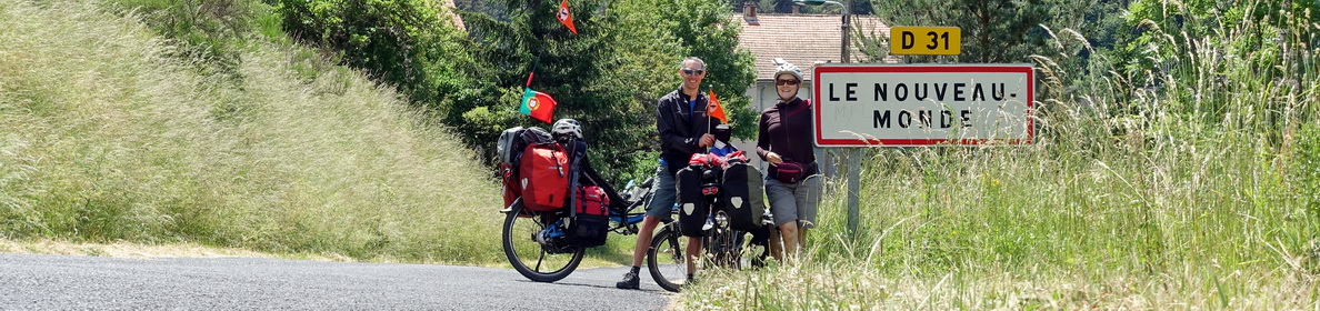
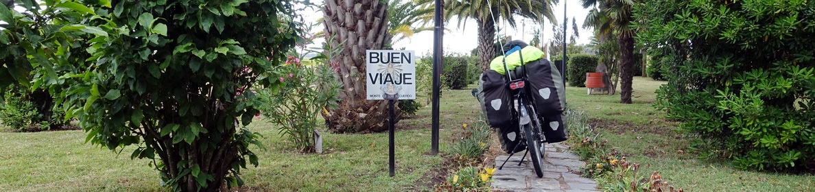

Another one of our So, how was it? posts, describing our experience border-hopping between Argentina and Chile: Paso Carririñe, Paso Hua Hum, Ruta de los Siete Lagos, and Paso Pérez Rosales (Cruce Andino), from the 1st to the 12th of January 2017.
If you understand French, you can also read our more descriptive travel journal in French: Feu et glace – la traversée des Andes.
Table of Contents
The route
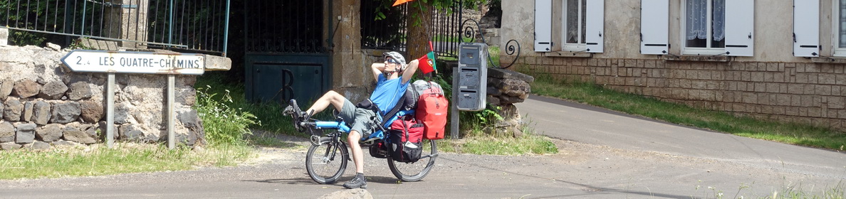
Paso Carririñe: From Junín de los Andes to Liquiñe, and on to Puerto Fuy
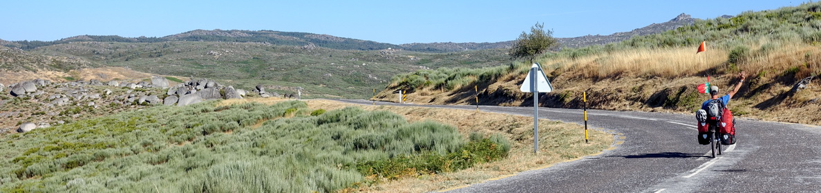
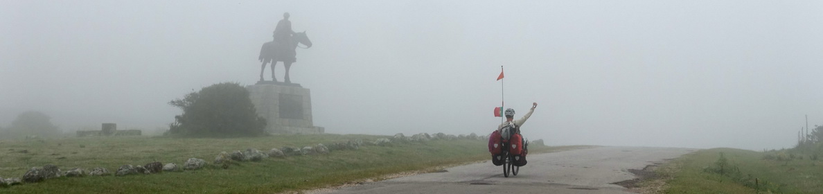
We decided to take this non-asphalted pass, because it was little used. There was not much information about the road conditions for bicycles, but we felt a bit adventurous and wanted to explore it. We checked at the tourist office in Junín that the border post was open (it had been closed for a while because they built a new border post on the Chilean side), and left Junín on New Year’s Day. It was supposed to be summer, but our thermometer showed only 6°C in the morning! The weather was beautiful though, and it would warm up, without being too hot.
We took the non-asphalted route 65 (later joining route 62), which was very quiet on that morning. This was our first “real” experience riding all day on the famous ripio – the English word for this would be “gravel road”. Road 65 had several variations of ripio, from well-compacted gravel to slippery sand, to very coarse and loose gravel and compact, humid dirt. We quickly noticed that our average speed would be much slower than what we were used to… and that this would also be more tiring. And although there were not many cars, the ones that passed us would quickly cover us in dust. But the road was quiet and the views were great, and we enjoyed it very much.

The road followed a river and passed several lakes. There were simple camp sites by each lake, and we had a picnic in the first one by Lago Curruhue Chico (the camp site seemed closed or abandoned). It was after this that the road got a bit annoying, it was a sandy stretch going uphill. We had to push a few times, when the sand was too deep to pedal.
We were rewarded by a beautiful road going downhill, a nice compact and humid dirt road going through a dense forest. We hadn’t seen a real forest since leaving Europe, so this was a special experience.

We also took a break on the small beach at the end of Lago Curruhue (Miguel even went for a swim in the cold lake), and walked around the El Escorial ancient lava flow, before stopping for the night at the abandoned thermal spa Lahuen Có. The camp site was very simple, and although there was a sign saying that you had to pay for using the toilets, there was nobody to collect the money, so we stayed there for free (on the next morning, Miguel also discovered that there were showers). We took our bath in the hot water pools of the abandoned spa. There was a wooden walkway connecting the camp site with the ancient spa hotel, passing several hot water “tubs” on the way. We had a soak and wash at the biggest tub near the ancient hotel, the water was a bit murky (there’s no maintenance any more), but it was very nice after a day of cycling.

On the next day, we cycled up the Paso Carririñe. The road was decent-quality ripio. There were a few steep parts where I had to push, but all in all this road was doable with touring recumbents (although we think that it could be more difficult after heavy rains). The Argentinian border post was at the beginning of the uphill – basically just two containers (from what we understood, the Argentinians and Chileans were both supposed to use the new building on the Chilean side, but things were supposedly slow and complicated on the Argentinian side, so they still had their own border post). We passed the border quite fast, although the customs official wanted to check what he called our “hand luggage” – he seemed very confused when he realised that this was not applicable to bicycle travellers! So, he let us go very fast.

The descent on the other side was more difficult. It was very steep and the road had recently been re-done – meaning, it was mainly composed of loose, rough gravel. After 3 kilometres of this, we reached the Chilean border post, located in the brand-new building (tip: they have nice toilets). It took a bit of time to pass the immigration process. Everything was very organized, and the officials were very friendly, but they were eager to do their job well. So, we had to register our bicycles (they want to be sure that you don’t sell them in Chile), and our bags were searched for prohibited food. Chile is very strict about people not bringing food that could contaminate their agricultural production, so you must declare all plant- and animal-based food items. We got through alright, the only thing they took was a bag of dried prunes (because they still had the pits). But we didn’t have problems bringing our other food, such as our muesli mix (oat flakes with dried sultanas), supermarket cheese still in its original and unopened wrapping, and bread.
We then continued downhill, which was a bit less steep and less slippery. We passed two Argentinians cycling the other way – the uphill seemed much more difficult (and longer) on the Chilean side. Whereas we had to put on our Gore-Tex jackets and could have worn gloves because of the cold wind, they were in shorts and t-shirts and sweating!
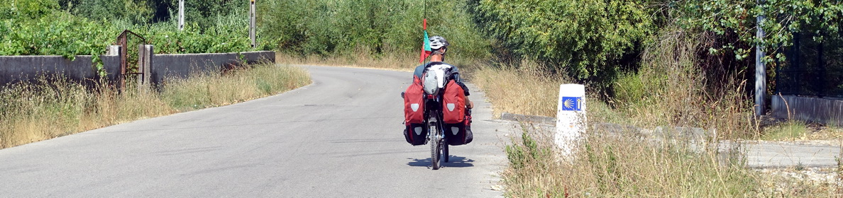
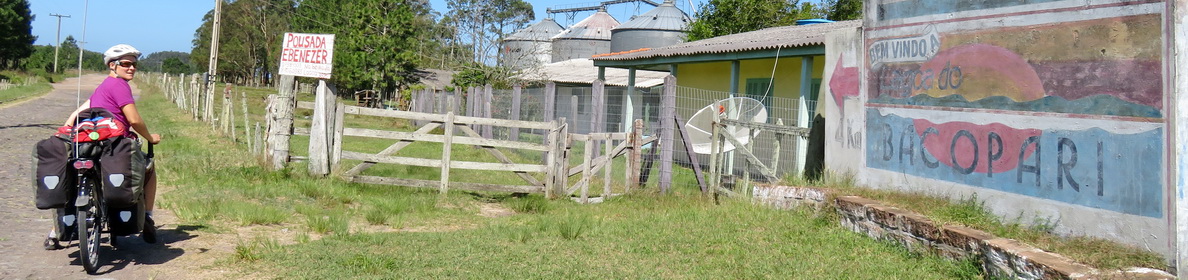
We stopped for a while in the first village, Liquiñe. We had no Chilean pesos and expected to find a place to exchange dollars or Argentinian pesos here – but there was none. There was no ATM either. Locals can get cash in almost every shop through a system called Caja Vecina, but their system doesn’t work with foreign cards. We were told that the next ATM was in Coñaripe, which was not in our direction, and that there would be no ATM on the way we had chosen. At the Termas Río Liquiñe (a thermal pool with a restaurant), they would have agreed to change US dollars, but at a very bad exchange rate. In the end, we found a shop owner who agreed to change 50 US Dollars at an acceptable rate, so we had at least some money to buy some food. Liquiñe has several thermal spas, but most of them were quite simple pools. In the end, after pedalling around for a while, we decided not to stay there and to cycle on until Quilmio, located on the T-29 unasphalted road towards Puerto Fuy. We stayed in a nice camp site, which only had cold showers, but it had a very well equipped refugio (a small house), with tables, chairs, a completely equipped kitchen, and a fireplace. It was all the better, as it started raining and rained for most of the night and again in the morning.

On the next day, we cycled to Puerto Fuy and had a complete experience of what Patagonian weather can be like in Chile: rain, wind, cold, and a bit of sun. The unasphalted road was of good quality and it led us through nice and dense forest. In better weather, we would probably have had nice views!

After passing Lago Neltume, we joined road 203 up to Puerto Fuy. A long stretch of the road had been recently asphalted, and it was nice to pedal until Neltume, where we had our lunch break. From then on, there were still road works going on, which made this stretch very tiresome to cycle – but for future cycle travellers, the road will probably soon be completely asphalted.
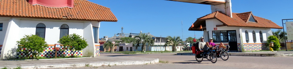
In Puerto Fuy, we had to search a bit for a place to stay where we could pay with credit card – some of the small shops accepted Visa credit cards, and it was through asking at one of those shops that we found a great deal: a cabana (small chalet, which most people in Puerto Fuy rent in their garden) with equipped kitchen, comfortable bedroom, a hot shower and a wood stove, for 20’000 pesos (a bit less than 30 Euros). It was a good choice, because it continued raining most of the evening and night.

Paso Hua Hum: From Puerto Fuy to San Martín de los Andes
We took the ferry across Lago Pirihueico on the next morning. To our surprise, bicycles also had to pay – this wasn’t written on their price list. And they didn’t accept cards… in the end, we had just enough Chilean pesos left to pay for our tickets and the two bike tickets (otherwise we would have had to pay with one of our 100 US Dollar bills – they wouldn’t have been happy about that…).

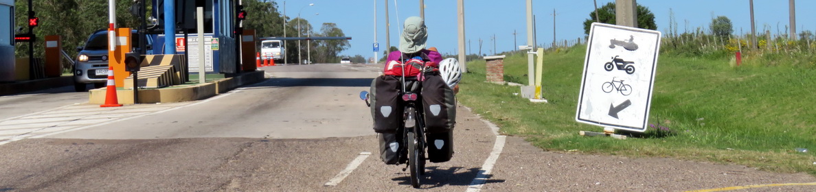
From the village of Pirihueico, where the ferry arrived, it was about 11 kilometres to the Chilean border post. Again, a very modern building, but a long queue of cars because some part of their electronic system wasn’t working. They had X-ray machines to check the luggage of people entering Chile, so if you’re travelling the other way, you’d better be careful about the food you bring… We got through very fast and were soon cycling on in the direction of the Argentinian border, whereas all the cars were still waiting in line!
A few kilometres on, we reached the Argentinian immigration. The atmosphere was very relaxed, and everybody seemed more interested in our bicycles than doing their job correctly, so immigration was again very fast. The customs official just asked us whether we were carrying any fresh food (such as fish or fresh fruit), which we declined (Argentina has similarly strict rules for importing food than Chile), and we were waved through.
So, we had crossed the Hua Hum pass without even noticing that it was there – we had done no uphill since leaving the ferry. This is one of the lowest passes of the southern Andes, at 659 metres altitude. However, we already knew that the real uphill was yet to come…

For the time being, we pedalled on a more or less flat road along lake Nonthue. The rain stopped, but the road was soaked and quite sticky. As we pedalled on, the air got drier and the road easier to cycle on. When we spotted a wooden sign pointing to a tea house, Café Quechuquina, we couldn’t resist, so we followed the sign along a forest track. We ended up in what seemed the middle of nowhere, in a wonderful café/restaurant between the trees, where we warmed up a bit with a coffee and a submarino (the Argentinian version of the hot chocolate).
It was after this that the uphill started. The road climbed up to over 1000 metres altitude in several switchbacks and on ripio that was ok to cycle on (a bit slippery at times but mostly well compacted).

It was the downhill towards San Martín de los Andes that was more difficult, as most of it was on fresh (i.e. non-compacted) ripio, so we had to go slowly to avoid slipping. Only the last bit of road was asphalted. We arrived in San Martín tired and cold and went about the difficult task of finding an inexpensive place to stay. After trying a couple of hostels that were full, passing by the tourist information office that was packed, and a hospedaje (guest house) that was also full, we ended up in a simple room in a hospedaje, for which we paid too much for our taste – we had arrived in tourism-land. After crossing inland Argentina, this was something completely different. The streets were full of tourists (Argentinian and foreign), there were trendy (and overpriced) cafés and restaurants and tour-operators everywhere. We stayed two days to get our laundry done and relax a bit, and then escaped back into the nature.
Ruta de los Siete Lagos: From San Martín de los Andes to Bariloche
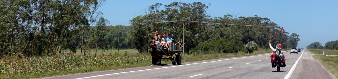
Cycling the Seven Lakes Route was our main reason for coming back to Argentina from Chile. We had been told that it was beautiful – and we confirm that it was. We were lucky to have good weather, so we had nice views of the lakes and surrounding mountains. And although there were many uphills, they were never too steep on this all-asphalted road.

Compared to what we had done before in Argentina, this was an entirely different experience. We were by far not the only cyclists any more – this route is very popular in summer. We saw lots of people, some on rental bicycles, cycling from San Martín to Bariloche (or the other way). There were also a lot of mochileros (young backpackers), doing the route mostly by hitchhiking. Most of them had such huge backpacks, they could hardly walk a few metres.


The downside of this was that the camp sites were packed. We had originally thought stopping at Lago Falkner, but the long queue of parked cars made us pedal on until the Pichi Traful camp site, a couple of kilometres off the main road on a dirt track. It was a beautiful camp site, nicely located by the lake and between the trees – although we found it a bit overpriced for the services offered.

The fact that this camp site was also packed with mochileros (they arrived all along the evening, every car arriving would drop off at least 2 or 3 of them) made it a not-so-nice experience: queues in front of the showers, a packed and noisy café/bar, and lots of noise for half the night (despite the rule of “absolute silence from 23h”).
On the next day, we continued until Villa la Angostura. The weather was a bit overcast, but we didn’t get rained on and we had some nice views of the lakes, which were visible from the purpose-built viewpoints, usually full of cars…

The last stretch of road, where route 40 joins route 231 coming from Chile, was busier with traffic, especially trucks and buses, but it was ok for cycling. In Villa la Angostura, we offered ourselves the luxury of a two-night stay in a nice cabaña, because of the forecast of heavy rain, which started on the evening we arrived. We stayed mostly inside – we found Villa la Angostura just a touristy, overpriced village.
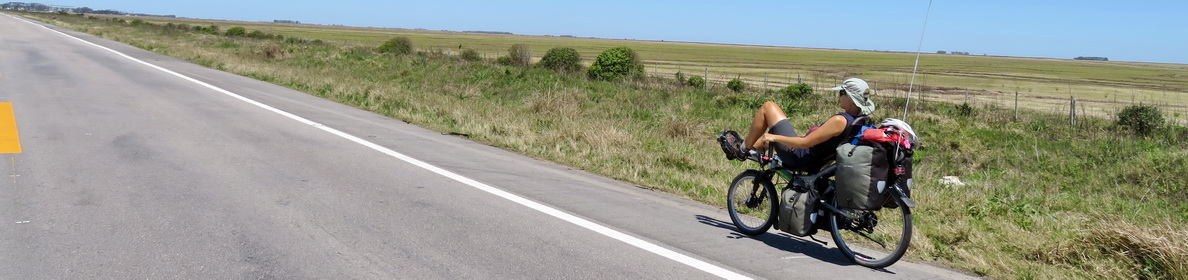
When we continued in the direction of Bariloche, the sky was still overcast and it was chilly, but we had a great backwind for much of the time. The road was nice, we had what would be our last views of typical Argentinian, “big-sky” scenery.

The road was busy though, we had to be aware especially of trucks and buses, although it wasn’t as bad as in other parts of Argentina (see this post for more info) as the road was larger and had a rideable (although not asphalted) shoulder most of the time.

We stopped for the night in Dina Huapi, a village a few kilometres before Bariloche. The small tourist information office directed us towards the camp site. It turned out to be the local sports ground, with a (not yet functional) swimming pool and just basic toilets and shower – basically, the kind of place where we had camped several times all across Argentina, except that this time it was not for free (and we felt that it was even quite overpriced for what they offered – malfunctioning showers and very basic infrastructure). At least we could use a simple refugio for cooking and eating out of the wind.
The next day we cycled to Bariloche, where we stopped in the centre to get a few things done, such as changing our remaining Argentinian pesos for Chilean pesos – we didn’t want to be caught again with no money! There was a long queue in front of the official exchange office, so we exchanged with one of the guys in the street, for an acceptable (although not great) exchange rate. We also bought our tickets for the next leg of our trip – crossing the Andes yet once again by bike and boat.
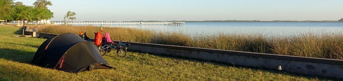
As we had to be quite early at the ferry terminal the next morning, and we didn’t feel like staying in Bariloche, we got on our bikes again in the afternoon and cycled in the direction of Llao Llao. For this last stretch of road in Argentina, we were accompanied by non-stop traffic – at least we weren’t sad to leave the country! We spent the night at Camping Cirse, which was a nice camp site which had different areas to choose from – we chose the one without barbecues and without artificial light, but with a view on the lake.

Cruce Andino by “bike and boat”: From Bariloche to Puerto Varas
We left Camping Cirse at 8 am and pedalled in the direction of Llao Llao and its ferry terminal. The road was quiet, the weather was perfect, and we were there fast. We had to pay an extra “harbour tax” (fortunately we still had some Argentinian pesos left), and then spent our leftover money in the café while waiting to board the ferry. There were several cyclists – an Argentinian traveller we had already met several times in camp sites, three young Chileans on mountain bikes, and an English guy travelling from Ushuaia to Colombia, with whom we would spend part of the next two days cycling and camping. We had to take off all our panniers, which were loaded onto the boat by the crew (as were the bikes). The first boat trip took us across Lago Nahuel Huapi to Puerto Blest. It was a very nice trip with beautiful scenery.

In Puerto Blest, we recovered our bikes and cycled about 3 kilometres to the next boat. It was a flat ripio road, and we arrived before the bus carrying the other passengers. Our panniers were transported with the other luggage in a small truck. The second boat trip across Lago Frías was shorter, but equally nice.

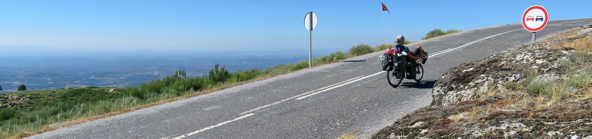
When we arrived in Puerto Frías, we were immediately directed to the Argentinian border post, where we got our exit stamps. We then recovered our bikes and panniers and got ready to cycle the next 29 kilometres. We left Puerto Frías at 13h, and it started with a tough, 3 kilometres uphill to Paso Pérez Rosales. There were some steep parts with loose ripio where we had to push, otherwise we managed to pedal everything, and it took us 45 minutes to arrive at the top.

After a quick picnic, we started the downhill. We were pretty relaxed, thinking that it was all downhill from here and that we would have no problems reaching the third boat which was supposed to leave at 16h30 – we had two and a half hours left. The ripio on the descent was all right, although we couldn’t go very fast because of the loose gravel. When the road flattened, we passed a building of the Chilean carabineros with a nice picnic spot next to it – this was probably the spot where some cycle travellers doing the trip in the opposite direction had camped, as we had read in their blogs. We just took some photos and continued, while the three Chilean cyclists stopped there for picnic.

The route was great. It was all ripio, most of it ok quality, the scenery was beautiful, it was quiet, there was no traffic, it was flat. We passed a large river, and a waterfall, but didn’t stop for long since we had our boat to take.

Suddenly we started realizing that the time was getting tight. We pedalled faster, but it was tiring because of the gravel road, and it was not downhill anymore, but flat. Towards the village of Peulla, the ripio got really bad – the truck had just dumped plenty of fresh gravel on the road, and it was almost impossible to cycle. We arrived at the Chilean immigration post at 16h15 – fortunately they let us pass quickly. It was a different story for the registration of our bikes, which was in a different office and the officer there was very slow. At some point, she told us to just go and get our boat, but we didn’t know whether we would have trouble leaving the country without this piece of paper (we now know that it doesn’t seem to be important – many cycle travellers don’t get it when entering the country).
We arrived at the port five minutes before departure, quickly unloaded our panniers and had our bikes loaded onto the boat. We were exhausted. When the boat was leaving, we saw the Argentinian cyclist arrive – a few minutes too late. We later knew that he (and the three Chileans who also missed the boat) were able to get onto a later boat without paying a new ticket.
The highlight of the third crossing was the view of the volcano Osorno.

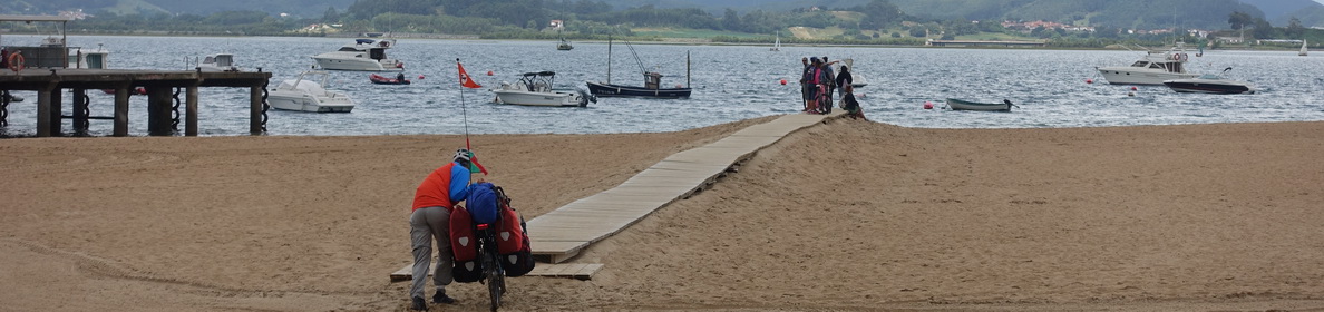
We arrived in Petrohué in the early evening, at around 18h30. We were told that the camp site marked on Google Maps was closed, so we organized a boat to take us across the river to another camp site. The small boat took the three of us (us two plus the English cyclist) for 1000 pesos per person plus bike. The camp site on the other side was nicely located by the river and with a view of the volcano, but it was not well maintained – there was rubbish lying around, and the services were very basic. The only advantage for us was that they charged the price per tent and not per person.

The next morning, we had to organize a boat again to get to the other side, which was a bit difficult at first as there seemed to be nobody up and around at 9 am. Although the days were long, people usually got up late in Argentina and Chile.
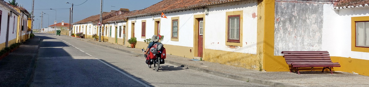
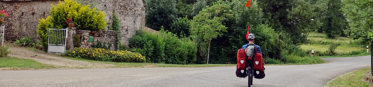
We cycled to Ensenada together, the first part of the road was not asphalted (yet) with some road works going on, but then it became asphalted and even had a cycle lane!

In Ensenada, Seb (the English cyclist) found a camp site where he would stay for a few days – we regretted a bit not having come here the night before, it would have been much nicer. We continued along the lake to Puerto Varas. The cycle lane continued all the way to the town, and there were many small shops, cafés, and restaurants along the road.

We liked Puerto Varas – it was a bit touristic, but still had a good amount of local life. It had good shops, a big supermarket, a few nice restaurants serving something else than meat and fries, and a nice lakefront. We spent a few day there relaxing and planning the next leg of our journey – the northern part of the Carretera Austral.

The drivers and the people
Please refer to the corresponding sections in our How was it – Argentina and How was it – Chile (coming soon) posts.
Basic necessities: water, food and sleeping
Water
All the roads on this section followed a river or lake, and most of them (except the first part) were in very touristic areas. We never had problems finding water to drink. It also helped that the weather was quite humid and the temperatures mostly fresh.
Food
Outside of the bigger towns of Villa la Angostura, Bariloche and Puerto Varas, there were only small shops with a limited offer of food, and not many restaurants or cafés. We self-catered most of the time, cooking and eating whatever we found in the shops. On the Chilean side, we recommend getting the excellent empanadas for picnic – they are bigger and way better than their Argentinian counterparts.

Sleeping
There were many camp sites on the way. We found most of them rather expensive for what they offered. Especially on the Chilean side, where there is more rain, it can be a good idea to look out for a camp site offering a sheltered area, called a refugio. There were also many guest houses (hospedajes) and more expensive hotels.
On the Argentinian side of Paso Carririñe, there were three simple camp sites: Lago Currhué Chico, which seemed to be semi-abandoned or closed, Laguna Verde (next to Lago Currhué Grande), which we didn’t see (people seemed to be camping there), and Lahuen Có, where we camped for free. There was a sign for a camp site one hour on foot from the El Escorial lava flow in the direction of the lake, although we have no idea if it exists. On the Chilean side, there was plenty of choice for accommodation.

On the Cruce Andino, we were told by the ticket office that the only accommodation option was the expensive (over-priced?) Hotel Peulla. However we know of several cycle travellers who have free camped on this route. Seb, our English cycle companion on this stretch, also told us he had seen a sign for a camp site a bit before Peulla. We didn’t like the camp site in Petrohué, it was dirty, very basic, and full of sand flies. We would rather recommend cycling to Ensenada where there are better choices – the road is asphalted and downhill.
Money
As we described above, we had trouble getting Chilean pesos or finding an ATM in small villages in Chile, so it’s important to exchange at least a little bit of money in Argentina. On the Chilean side of the passes they would accept pesos argentinos, but at a very bad exchange rate. Also note that you can’t exchange US Dollars directly to Chilean pesos in Argentina, you have to exchange to Argentinian pesos first.
Dangers
The only dangers we encountered on this stretch of road were the motorized traffic (on the Seven Lakes Route) and some steep downhills (although they aren’t a big danger if you go slowly). We crossed paths with a huge spider (tarantula?) on the road to paso Carririñe, no idea whether it would have been dangerous. In the same region, signs warned us about a specific kind of wasp, but we didn’t see any (or just very few). We also didn’t see many of the famous horseflies (tábanos).

Orientation
Our GPS App (OsmAnd) was useful, as usual, especially for estimating elevations. Some secondary roads (such as the one from Liquiñe to Neltume) were not signposted. We didn’t use any paper maps for this region.
Weather
For the first time on our trip, we got a lot of rain, especially on the Chilean side of the Andes, but also around Villa la Angostura. Evenings and nights were quite chilly, and sometimes we woke up to temperatures as low as 6°C. We were lucky with the weather for the first part of the seven lakes route and the cruce andino – it wouldn’t have been the same without the views. Wind was not much of a problem in this mountainous region, except on a stretch towards Bariloche (but we got tailwind there).

So, how was it?
This part of our South American journey was beautiful, we would recommend it to others and do it again ourselves. There were some tiring uphills and the roads were not always in very good condition, but the scenery made up for this by far. On the higher passes (Carririñe and Pérez Rosales), the Chilean side is steeper and has much more elevation, so we recommend doing them as we did, from Argentina to Chile. We met several cyclists coming the other way and suffering…
The nicest part was Paso Carririñe, because it was so quiet. The landscape was also interesting, with mountain views, lakes, and forest. We would definitely recommend exploring this little known pass. If the weather is nice, if you have enough food with you and don’t mind being away from phone network and Wifi, this region would certainly be nice to spend a few days relaxing, swimming and trekking.
The most touristic part was clearly the Seven Lakes Route, which we wouldn’t recommend cycling in the busiest period as we did (beginning of January). There were lots of people on the road and the camp sites were packed. Better do it off-season and enjoy the calm.
The Cruce Andino (bike and boat) was beautiful. We recommend doing this with good weather only – you’d miss all the nice views in bad weather, which would be a pity. We’d also recommend doing it over two days and spending the night in the region of Puella – we had to rush to get the boat, which was a pity as this was such a nice region. You could sit by the river, explore some of the waterfalls or just enjoy the views on the mountains.

I really enjoyed your report of cycling in the Andes.
Could I ask for some advice please? My wife and I plan to fly to Bariloche next January, and ride down the Carretera Austral in Chile. It seems best to use the ferries across the three lakes west of Bariloche. I can’t find any information about these ferries, apart from organised trips which include buses. Could you tell me if you booked your ferries when you were there, or did you book in advance? Also, what was the cost?
Thanks for your help?
Steve
Hi,
You can find all the information about crossing from Bariloche to Chile by boat with bicycles at https://www.cruceandino.com/cruce/EN/bike_OWARCL/bike-and-boat-oneway-argentina-chile
The page says its 121km cycling, however we stayed at a camping closer to the port and slept then in Petrohué, just at the end of the last boat.
There is a better camping 15km after Petrohué.
Cheers,
Eva & Miguel