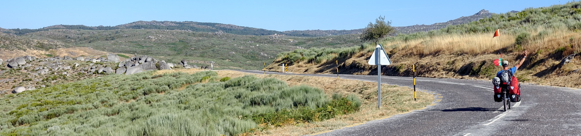
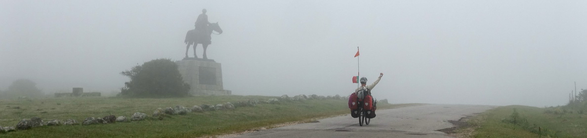
Table of Contents
In this blog post, we share our experiences of this 5 nights / 6 days self-supported trip. We organized everything ourselves and did not have a tour guide. We relied on our vast experience of ski touring in the Alps, we know how to cross-country ski, how to navigate using different means (GPS on phone and watch, map, compass), and are comfortable with different snow and weather conditions. For unexperienced people, there are guided trips to the National Park.
Practical things
Orientation, compass and maps
We printed maps for each day of our journey, drawing the planned path on them. On the back, we described the route (distance, azimuth, surrounding hills, altitudes) to help us memorize it.
While writing this post, we discovered the site https://pullautuskartta.fi/, which allows easy printing of maps at the correct scale and resolution. For our trip, we used screenshots, which varied in scale each day.
There is no internet connection in the National Park (except on some hilltops) and no electricity in the huts. It’s essential to be able to navigate without relying on a phone or GPS. Carrying one or two compasses and knowing how to use them is crucial.
We decided to keep one phone off while the other was in airplane and low battery mode during the day, stored inside two layers of clothing on cold days. This allowed the battery to last five days. On the fifth day, we almost lost the phone in a lake. We had a power bank that could charge the phone two or three times. Additionally, we had Garmin watches with GPS and GPX tracks.
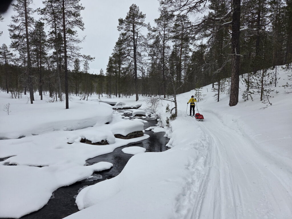
Our week was blessed with good weather, allowing us to follow pulka or snowmobile tracks most of the time. On the second day, snow and wind made navigation more challenging.
Reading Finnish topographic maps
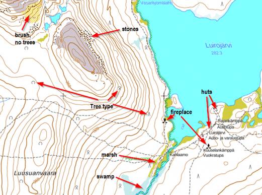
Our perception of Finland, beyond its cities, is that it is full of trees. Never-ending forests and a few hills. Finnish topographic maps aim to distinguish these landscapes.
In these maps, forested areas are left uncoloured, represented simply in white. Areas without trees, such as swamps (light blue), marshes (yellow-green), brushwood (yellow stripes), or exposed bedrock (grey), are highlighted with specific colours.
Within the white forest areas, there are four distinct symbols:
- Coniferous trees (like pines, which stay green all year round)
- Deciduous trees (those whose leaves change colour and fall)
- Mixed forests (a combination of coniferous and deciduous trees)
- Scrub (low brush, grass, and some trees).
In addition to the usual blue lines and areas for rivers and lakes, there are symbols for water springs and wells, which can be useful for collecting liquid water in winter.
The contour lines in Finnish maps are thicker every 20 meters and thinner every 5 meters (for comparison, the Swiss 1:25000 maps where contour lines are thicker every 100 meters and thinner every 10 or 20 meters). Steep areas are marked in black, and larger stones are indicated with black triangles.
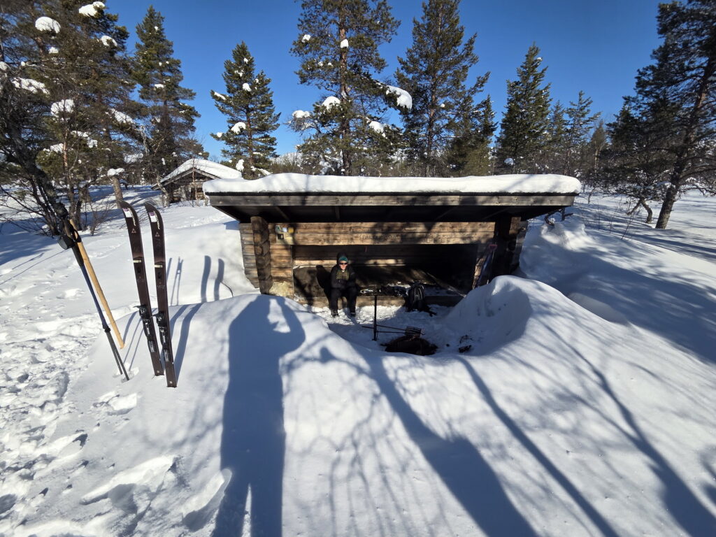
There are prominent symbols for fireplaces, where fires are permitted. Huts and shelters (Laavu) are barely visible on the maps, with their names written next to their locations.
Using Finnish topographic maps offline
First option – OsmAnd+
We are big fans of the OsmAnd+ app for offline maps. With some effort, it’s possible to get Finnish maps as an overlay. In the menu, go to “Configure map,” activate “Overlay map,” and add “MML Peruskartta” (Basic Map). These overlays are usually online. To download them, go to the desired area, long-click on the map, select “Actions,” and “Download map.” You can choose the minimum and maximum zoom levels. Unfortunately, the process was slow and often hung, leaving us unsure if the maps were downloaded correctly.
Final choice – Topo GPS
We discovered the Topo GPS app, where for 3 Swiss Francs, we could buy the Finnish topographic layer for download. This app allows you to select the area you want to download, click “Maps,” and “Download map,” showing the percentage of the map available offline for the current area. This ensures you have every tile you need. The app also offers practical features for hiking:
- Easy access to the map legend on the “Maps” menu
- Simple distance and azimuth measurement for navigation
- Display of distances and bearing for each kilometre on imported the GPX tracks.
We end up using only “Topo GPS” during our six-day itinerary in the UKK National Park.
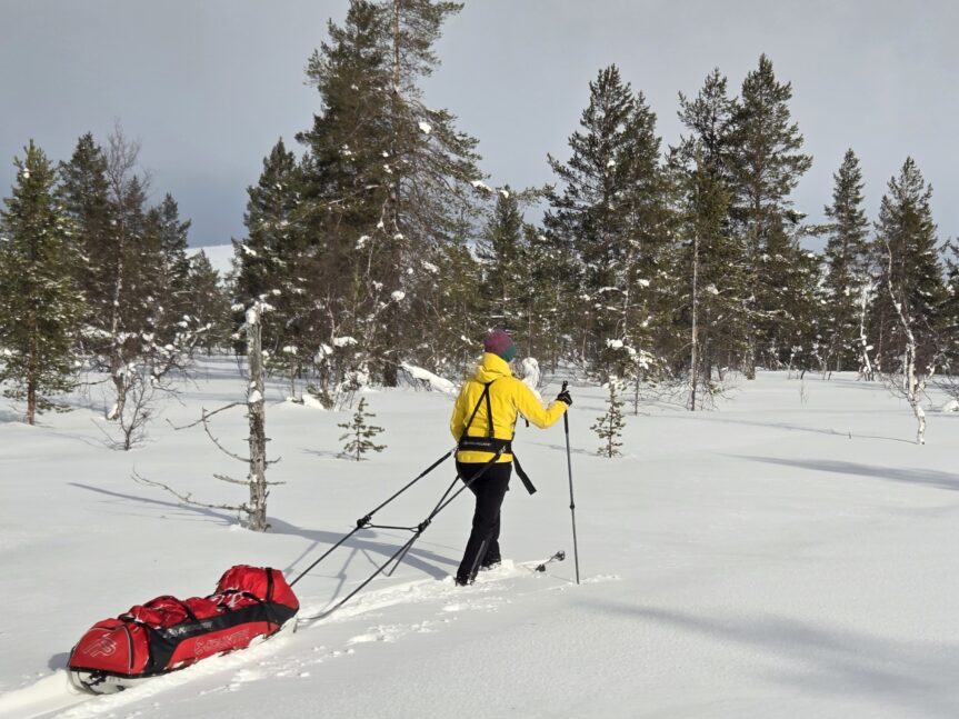
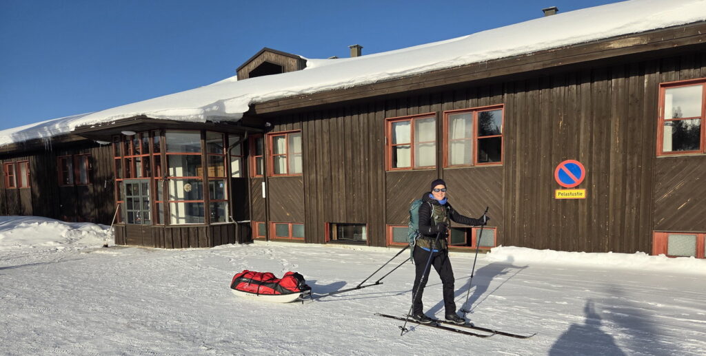
Our gear for 6 days forest skiing in Finland
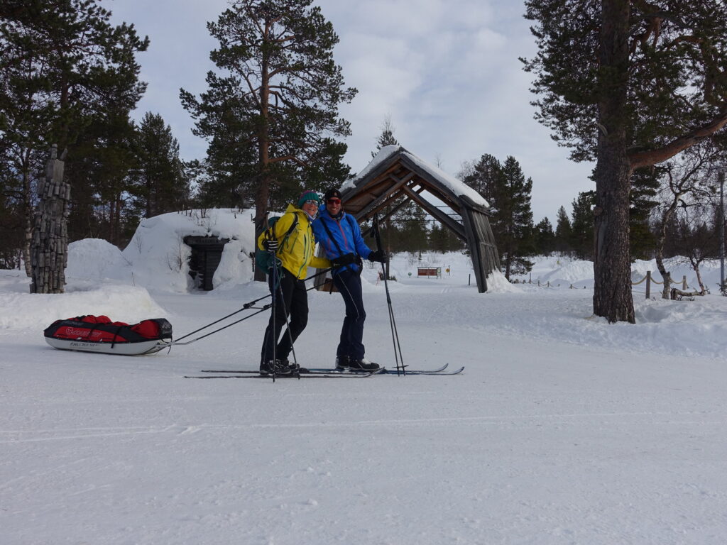
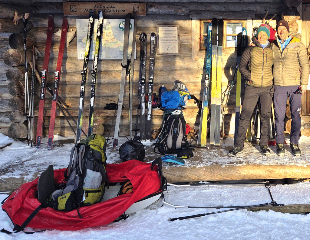
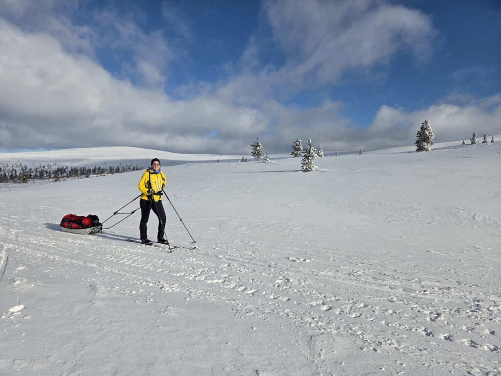
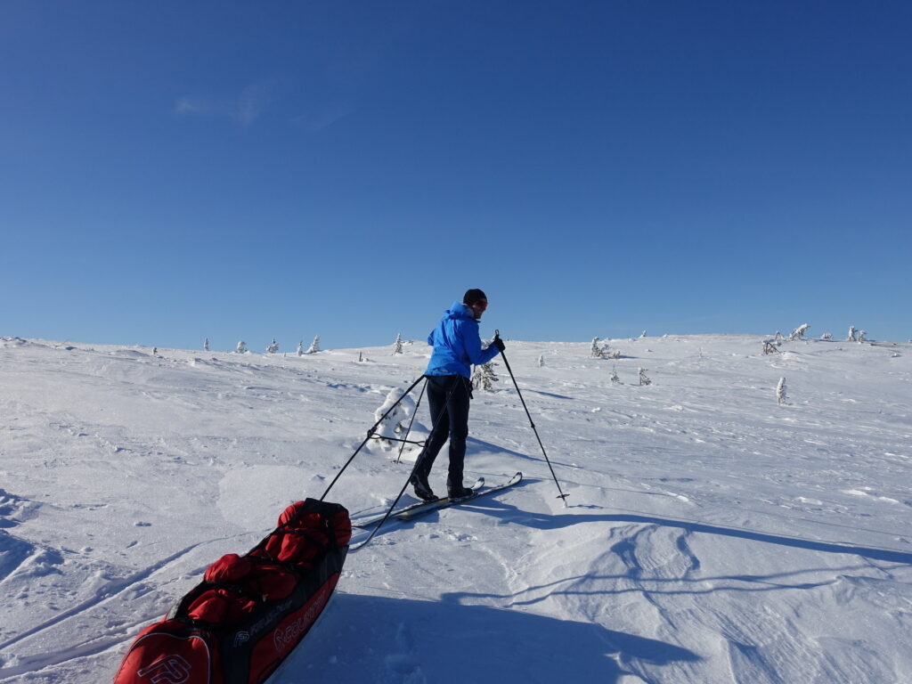
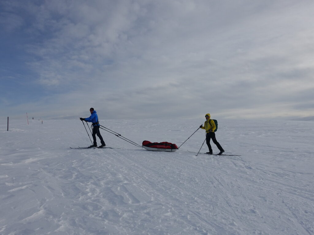
Skis, shoes, poles and pulka
We rented our equipment at the Kiilopää rental shop and were satisfied with it. The staff is knowledgeable about current conditions and recommended the best gear. In 2025, renting a pulka for five days cost 152€, and each ski set (skis, skins, shoes, poles) cost 196€, totalling 540€ for two ski sets and one pulka (they offered us one day for free).
We were advised to use “cross-country backcountry skis,” a mix between cross-country and touring skis. We rented Fischer S-Bound 98 skis (98mm at the front, 69mm in the middle), which have fish scales for minimal friction on flat areas and allow the use of half or full-length skins for climbing. The half-length skins proved very useful in most situations. There was no big snowfall predicted, mostly sunny and temperatures were rising towards 0° C by the end of the week.
The shoes were Fischer BCX Grand Tour, cozy and comfortable, and the only outdoor shoes we used during the trip.
We were provided with One-way (possibly BC Vario model) poles, which were length-adjustable and of high quality. The person behind often helped push the pulka with the pole.
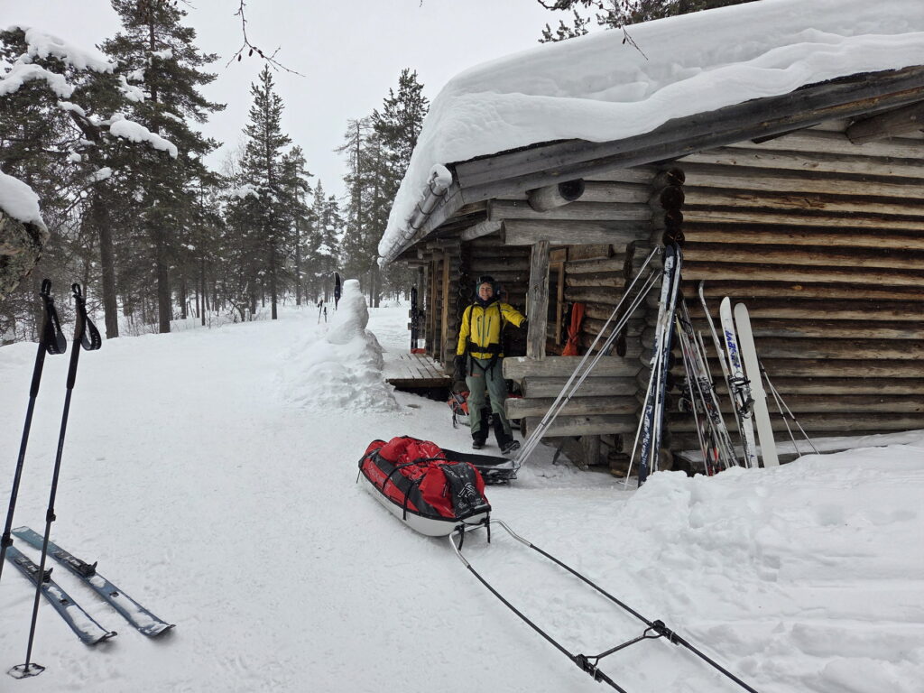
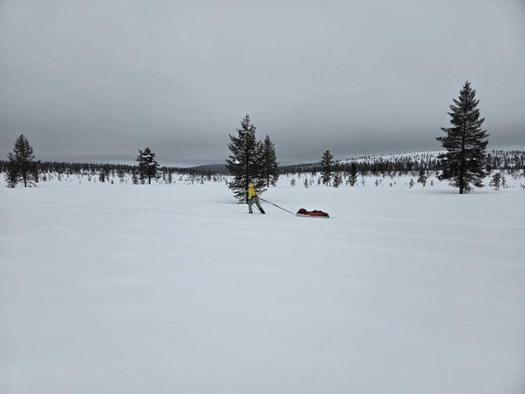
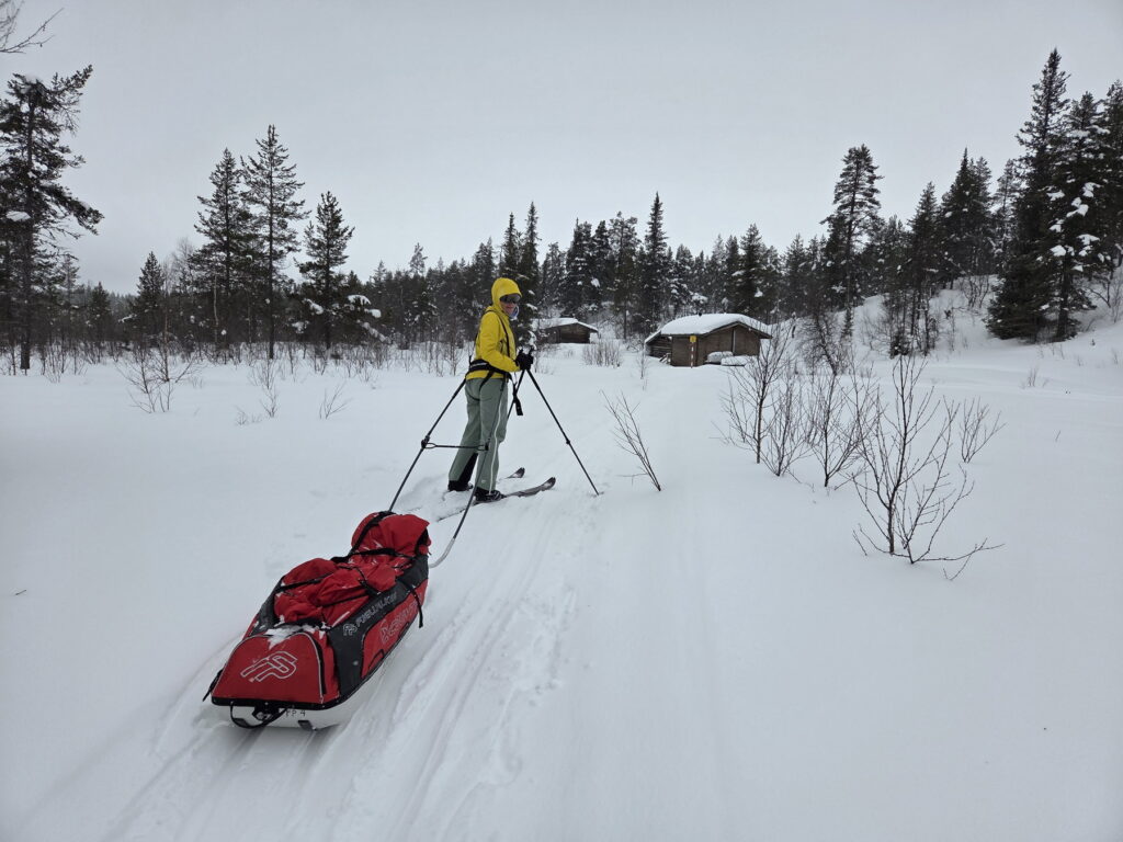
The “Fjellpulken Xcountry 144” pulka was big enough for all we carried. It was quite practical and robust. We had a simple harness that was adjustable around the waist and would go between the legs and over the shoulders. We deliberately chose to rent only one pulka for two people, which proved to be a good idea as we could take turns pulling it. Pulling the pulka uphill was very tiring especially at the beginning of the trip. The other person would carry a small backpack with the day’s picknick.
What we transported
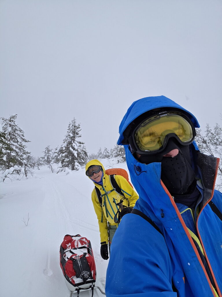
We stayed in reserved huts with mattresses. Open huts do not have mattresses! We brought warm (-10°/-15°) sleeping bags, cozy for the huts. We brought slippers to walk around in the hut (very useful, as the floor is quite cold and boots should be left at the entrance to avoid getting the floor wet). Headlamps were essential for lighting inside the hut and for going to the toilet in the dark. For skiing, we wore windproof cross-country pants. In colder or worse weather, we had touring ski pants as an overlayer. We wore long sleeve base layers and mid-layer jackets, adding a down jacket on colder mornings. On windy days, we completed our outfit with a Gore-Tex jacket. We had cross-country and warmer skiing gloves for colder days, and ski goggles for snowy, windy conditions.
We did not plan to camp outside, but for safety, we had the minimal equipment to be able to survive a night outdoors: A small shovel (from our avalanche kit) to dig a hole in the snow, a tarp (a large tent footprint), an emergency blanket (“space blanket”), and a gas stove (with a small winter gas canister bought in Kiilopää, which we could return if unused). Air mattresses or pads would be useful for protection against snow. Instead of a tarp, a light tent could be an option. Although we did not use this security material, we would carry it again as it happens often that people get stuck in a snowstorm, break material or have a small accident and do not manage to find or arrive to the hut.
What we missed
We missed something to diffuse the light in the huts. Some people bring candles, but next time we’d take a pouch for the headlamp, like the Petzl Shell Lt Pouch or Crushable Lantern shade from Montbell. This would allow to hang a headlamp from the ceiling and have more even lighting during the evening (for example during meals).
A better adventure knife would have been useful for cutting small bits of wood for starting the fire. Swiss knives were handy for cutting food but not efficient with wood.
A small wooden spoon for cooking would be useful, as huts lack utensils (there are usually one or two pans and a frying pan).
We carried a garbage bag but need a better quality one for multiple days in the pulka. All trash needs to be transported back to the starting point, so a couple of sturdy bags is essential.
We had limited amounts of matches and headlamp batteries; we would probably take a bit more next time to have enough backups, and carry them in different (waterproof) bags.
The most useful items
We were happy about our small seat pads for sitting on outside in the cold. One of the pads came from a biking backpack, the other one was cut from an old yoga mat.
Fire starters, such as burnable matches or tindersticks, were great for easily starting fires, especially as the firewood was often not completely dry and difficult to light.
Food and meals
Eva successfully used ChatGPT to get ideas and quantities of food to bring. We decided against pre-prepared meals (“adventure meals”) and informed ChatGPT. We also mentioned buying food in a Finnish supermarket and didn’t mind repeating meals for easier package sizes. ChatGPT even provided the Finnish names of products! At the supermarket in Saariselkä, the quantity seemed excessive, but it wasn’t. For instance, ChatGPT recommended 100/120g of porridge per day per person, totalling 1200/1500g for the week. We took 750g (packages were large) and ended up rationing. We needed a substantial amount of bread (flat bread like Ruispalat or Reissumies), having two sandwiches per person per day. Makkara sausages were nice to cook over the fire, but it took time to prepare and warm up the fire during the day.
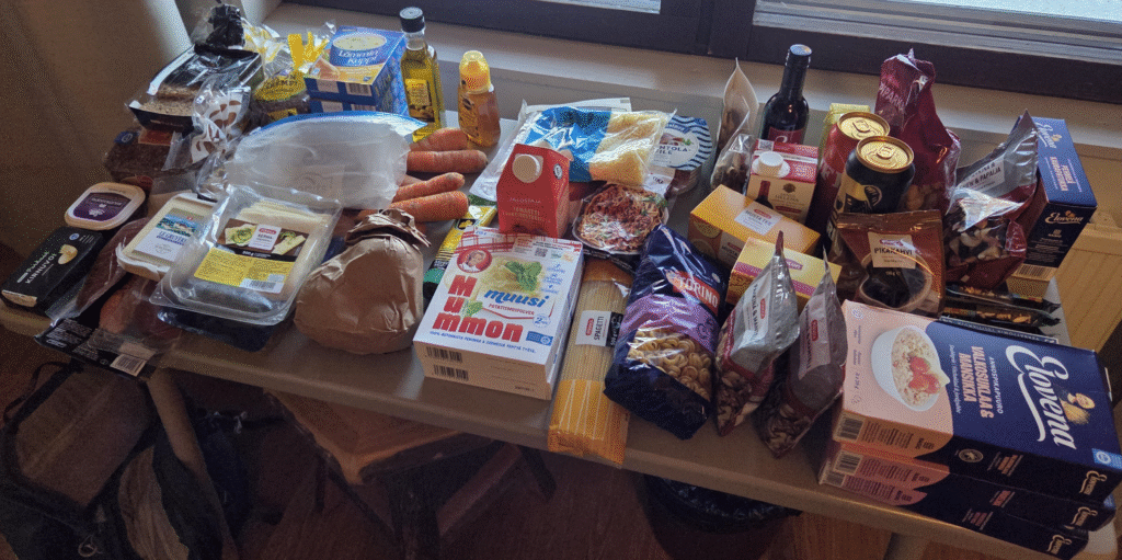
Our food plan included the following:
- Breakfast: Instant oatmeal, mixed nuts, honey, instant coffee
- Picknick lunches: Sandwiches with butter, cheese, and dried meat; instant soups; tea
- Dinners: fast-cooking pasta or instant mashed potatoes; dried mushrooms, dried meat, powder-based sauce, canned fish, and/or cheese
- Snacks: Dried fruit/nut mix, biscuits, chocolate, cereal bars.
We bought fruity tea and black tea, along with individual instant powder soup packages for drinking during the day (every morning, we prepared one thermos with hot water and another one with tea). We also took small tetrapaks of “cheap” wine from Alko shops, two beer cans, and a small bottle of Portuguese wine.
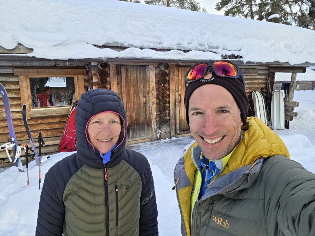
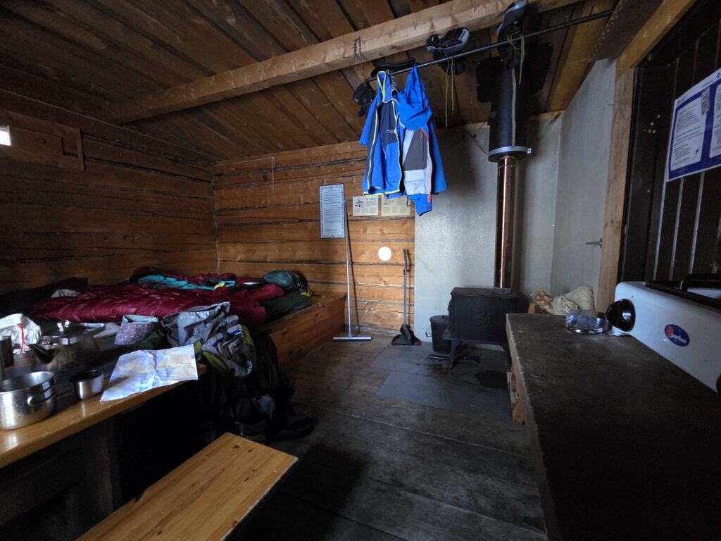
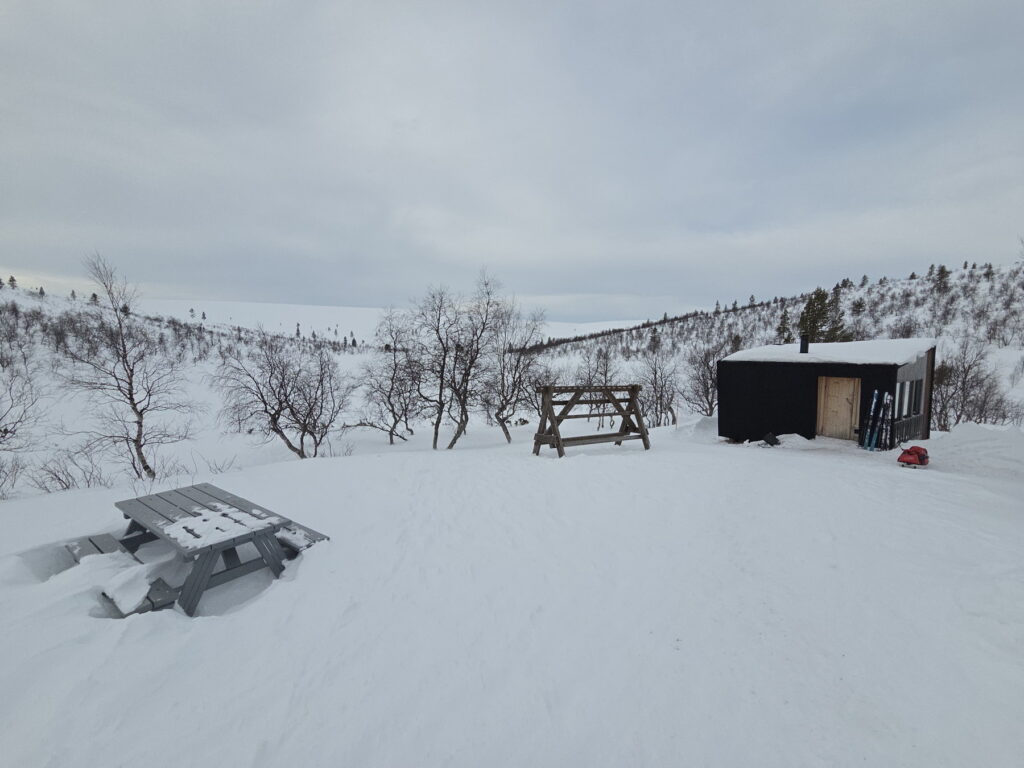
Accommodation: The huts
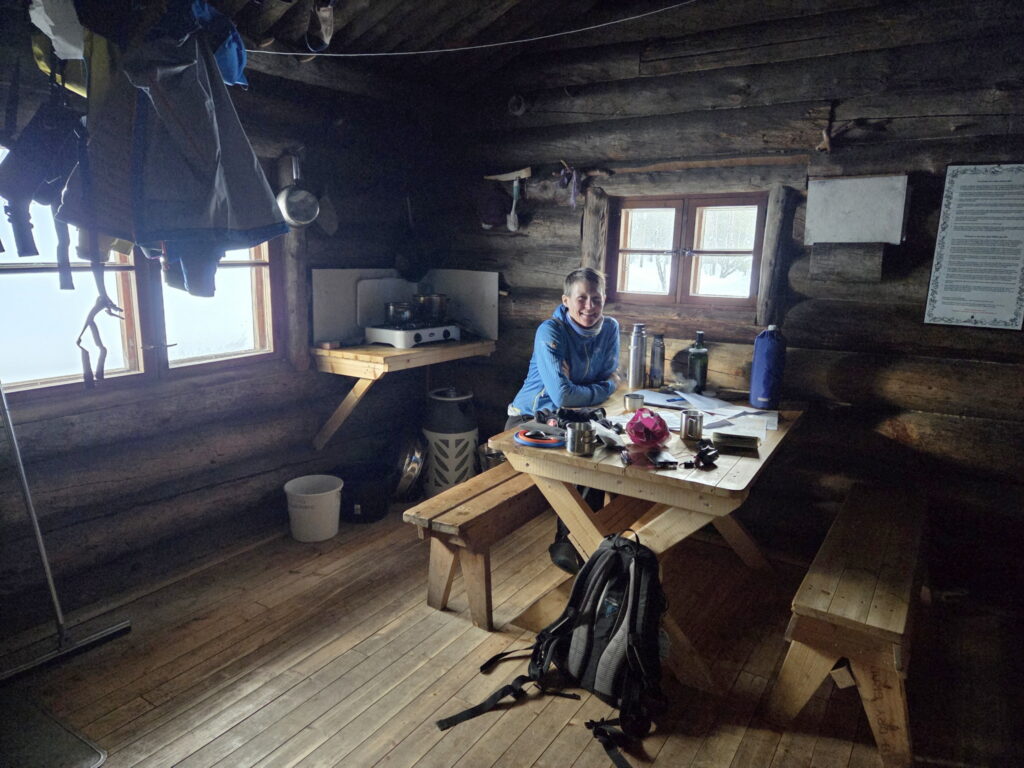
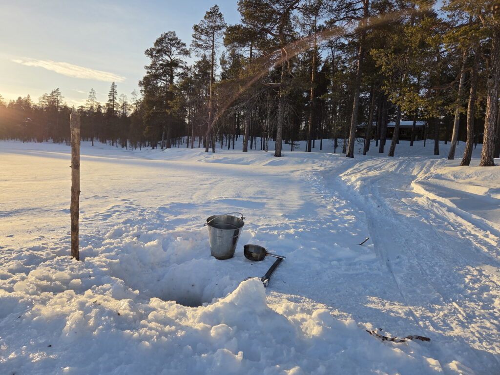
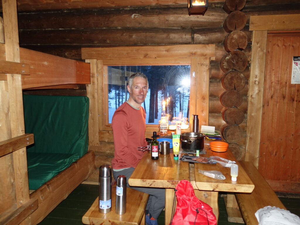
We reserved our spaces in the huts several months before the trip. The Finnish National Parks website has descriptions of all the huts and a reservation system with online payment. Most huts have an open part (free to use, “first come first served / make space for everyone” kind of system) and a reservable part (for a fee, accessible with a code for those who have reserved a space). The space for moving around, cooking, and eating is very limited, so it’s important to be very organized, keep your stuff together and be mindful of other people’s needs. For cooking there is a simple gas stove with two burners and usually one or two pots, so fast-cooking foods are preferable. There’s a wood stove for heating. Water is usually taken from a stream or river (using the “clean water bucket”) and needs to be boiled before use. There is plenty of wood, which in our experience was sometimes not very dry and took time to light. Toilets are outside (compost toilets), toilet paper is not provided. All trash needs to be carried back to the starting point. Some places have saunas (heated by a wood stove), which is nice to get a wash.
Kiilopää cross-country resort
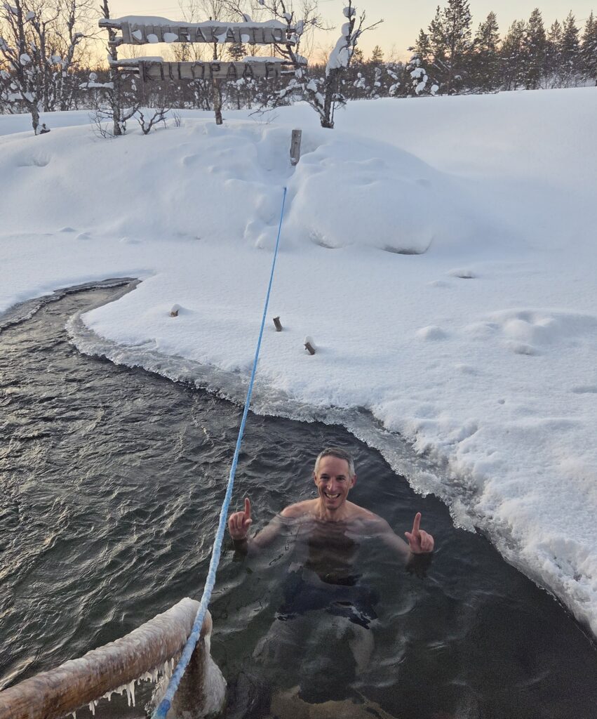
The Kiilopää “Fell-Centre” is a small resort for sporty tourists going to Lapland for cross-country skiing in winter. There’s a hotel built in the 1980s, a small hostel and a dozen of cottages for 2 to 8 persons. The hotel has a small shop, a canteen and a restaurant. There are free male and female saunas and a paid smoke (wood) sauna, along with an ice swimming/dip spot in the river. Hotel guests get breakfast included; otherwise, it costs 15€. Buffet dinner in the canteen is 28€, including water, served between 17h and 20h. The food is quite good, albeit the Finnish style (meatballs, reindeer stew, mashed potatoes, soup, among others). In the cottages, you can cook, but the supermarket is not easily accessible without car, located in Saariselkä.
Getting there, away and around
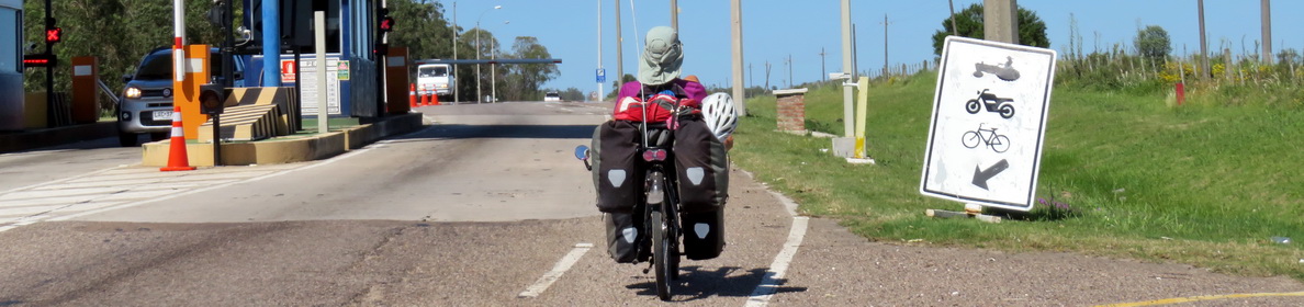
The nearest airport is Ivalo (Inari), 40km North of Kiilopää. We took a direct Edelweiss flight from Zurich to Ivalo. The Edelweiss flight was very comfortable, as the ticket includes the transport of luggage and food is also free of charge. However, contrary to the three daily Finnair flights, there was no shuttle bus to Saariselkä/Kiilopää related to our flight. We had therefore reserved a taxi for 120€ from one of the Saariselkä companies (Emails suggested by Kiilopää Fell Centre: pajarintaksi@saariselka.fi and info@taksisaariselka.fi). At the airport there were a few taxis waiting, but they might not have been enough for all passengers. However, it could be a way to share the price as the vast majority is heading either to Inari or Saariselkä/Kiilopää.
At the end of the stay, we went to Oulu for a few days, 470km South of Kiilopää. There is a daily bus driving from Karasjok (Norway) to Rovaniemi which stops at Kiilopää at 14:00. It has a connection with the night train to Helsinki leaving at 17:52 from Rovaniemi, which is perfect. This night train has both seated places and couchettes. Tickets for the bus can be purchased at https://www.matkahuolto.fi/ and train tickets at https://www.vr.fi/en .
Between Kiilopää and Saariselkä there is the Skibus once a day in each direction. It cost 6€ for the day ticket. It is also possible to use the Airport shuttle and its irregular timetable, with 9€ one-way ticket or the long-distance buses passing through once or twice a day – times in Google Maps, reservation/tickets at https://www.matkahuolto.fi/.
Saariselkä can also be reached with skis from Kiilopää; the shortest cross-country skiing track (about 11 km) goes over a hill and there’s also an easier, flatter, but longer track. We took the shorter route to do our food shopping for the backcountry tour but ended up with heavy backpacks, so skiing back was not really an option. After skiing to Saariselkä, we left the skis at the entrance of the shopping centre while doing our shopping. We then left our luggage in the shopping centre (for 5€), skied a bit more, and later took the Ski Bus back to Kiilopää.
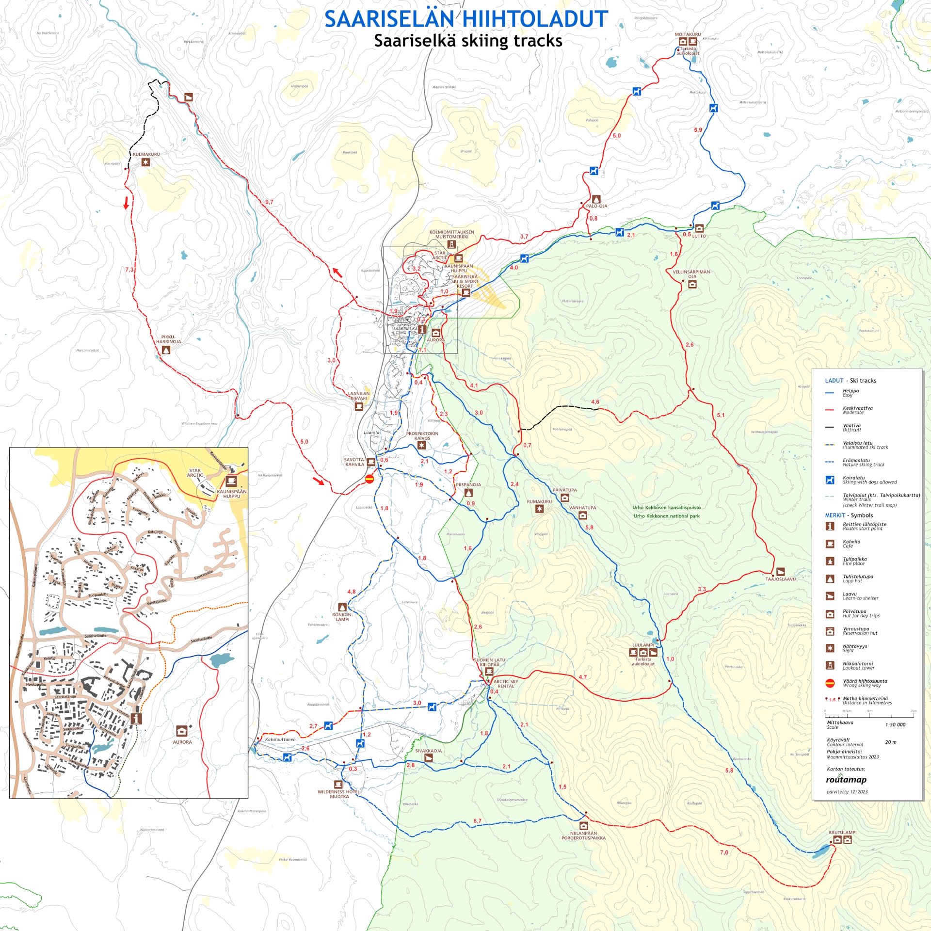
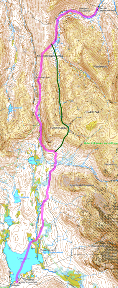
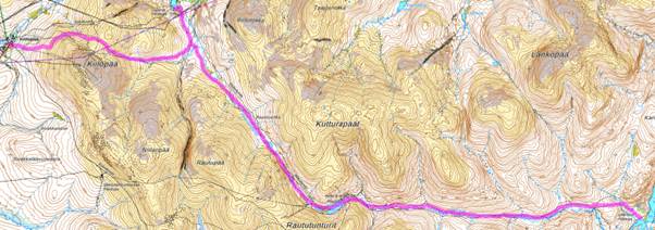
The 6-day itinerary in Urho Kekkonen (UKK) National Park
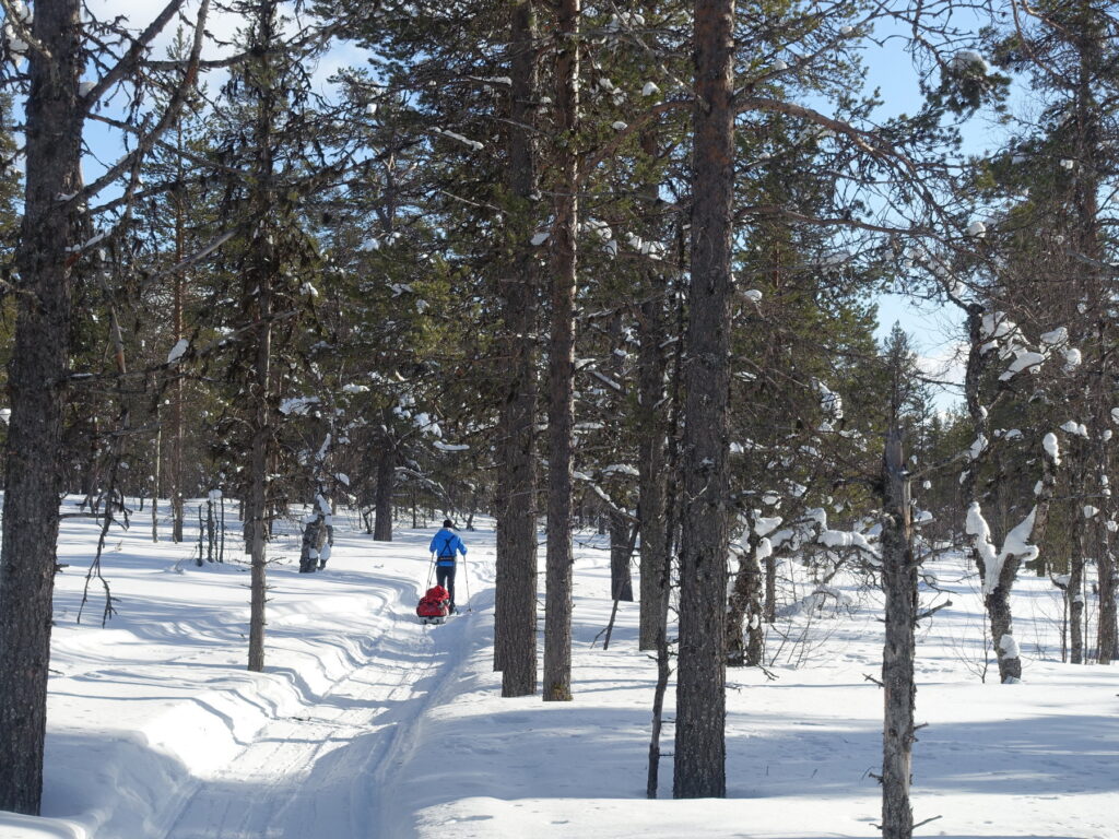
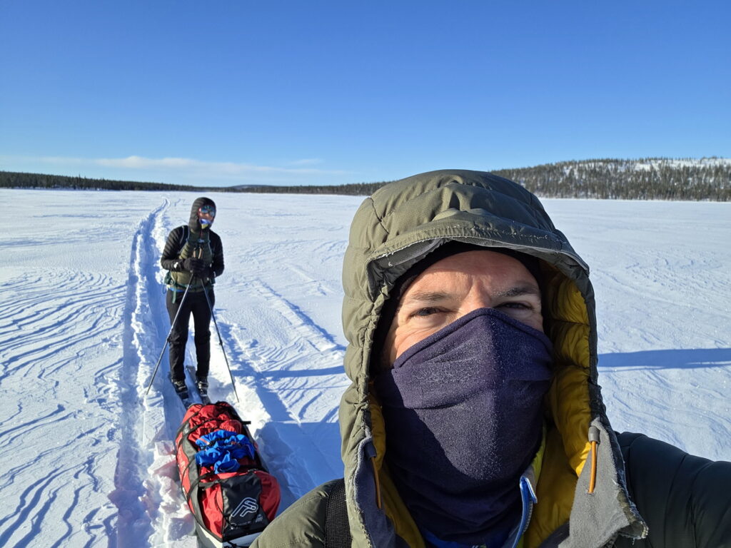
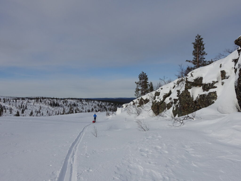
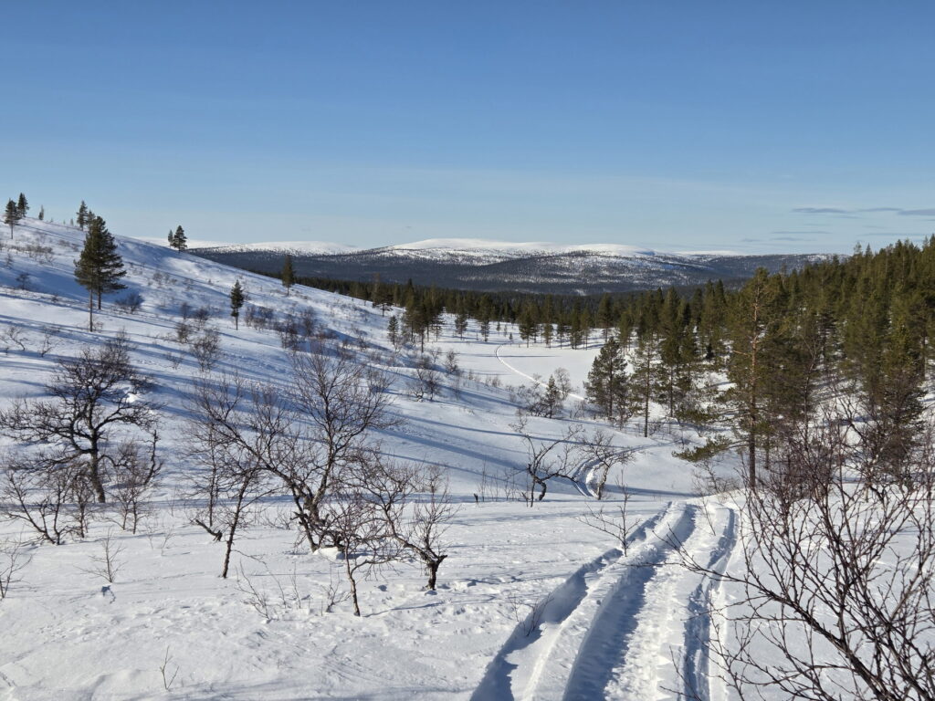
Here’s a summary of each day, including distance, height difference, and moving time based on our GPS statistics. We should account for 20 to 30 minutes of pauses per moving hour: a 4-hour moving time corresponds to a 5.5 to 6-hour skiing day. When we mention the [summer] “path,” we refer to the marked path on the maps. In winter, these paths are not visible, and they are not signposted, and we used a compass and GPS to follow them. When there’s no snow or wind, there are usually tracks from other pulkas or snowmobiles. We use cardinal points in English, such as SSE for South-Southeast (~157°).
Day 1 – Kiilopää to Suomanruoktu
15,15km | +186m | -230m | 3h45 | Sun/Covered
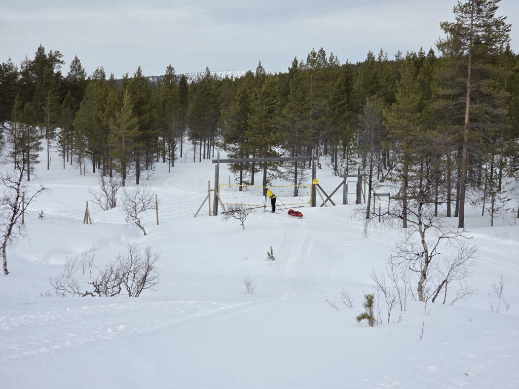
We left at 10 a.m. from the Fell Center using the cross-country tracks. Shortly after the sign to Niilanpään Päivatupa, we continued straight (SE), leaving the official track. We followed the summer path until the Firepit/Laavu, where we met a Finnish guy with long forest skis who was doing a similar tour but sleeping outside in a bivy bag! We enjoyed a picnic in the sun. Another option would have been to continue the marked nature skiing track from Niilanpää over a pass and, after reaching the river on the other side, head south (green line on the map). There would probably have been a snowmobile track to follow.
From there, we continued following an existing track on the right side of the river until the Suomanruoktu huts. Two Finnish men were already there, and a group of six Estonians arrived a few hours later. The open hut was also full. The Estonians had only four reserved places and asked if it was okay for the Finnish men and us to let them use the four places on the top bed to sleep six. They were considerate, cooking and eating mostly outside to avoid disturbing us. We saw a few reindeers during the day, the only ones for the whole week.
Day 2 – Suomanruoktu to Tuiskukuru
14,32km | +248m | -249m | 3h31 | Snow and wind
The Finnish men were the first to leave, heading back to Kiilopää. We left shortly after and were the first to go south. It had snowed overnight, and the snowmobile track was barely visible. After the marked firepit, we followed the existing track to the right of Vintiltunturi. Snow and wind made it almost impossible to recognize the snowmobile track. When it snows, it’s difficult to see the hills, as most of the terrain is flat. Despite a small disorientation, we managed to stay on course and enjoyed our first downhill ride along a well-marked track with the pulka pushing from behind! At Tuiskukuru, we were joined by the group of Estonians; the open part of the hut was again full.
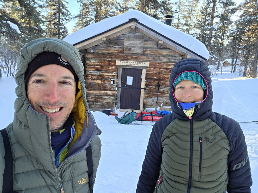
Day 3 – Tuiskukuru to Luirojärvi (Kuuselankämppä)
9,32km | +167m | – 170m | 2h35 | Covered / sun
We were the first to leave the huts again. Today was a short day with an almost direct route to Luirojärvi. There was a well visible track all the way, making navigation easier. We had reserved a small rental hut all for ourselves – Kuuselankämppä, which had space for five people.
Nearby, there’s a public sauna, and a couple of Finns were already starting the fire. We helped fetch water for washing. The sauna is scheduled for women in even hours and men in odd hours, with mixed sessions after 21h. While the sauna warmed up, we explored the lake surroundings with skis to prepare for the next day. Many people climb Sokosti, the highest hill in the UKK park. Later, we enjoyed the sauna, washing with a mix of hot and cold water. In the evening, Miguel returned to the sauna, where a group of French people in swimsuits were part of an organized camping tour.
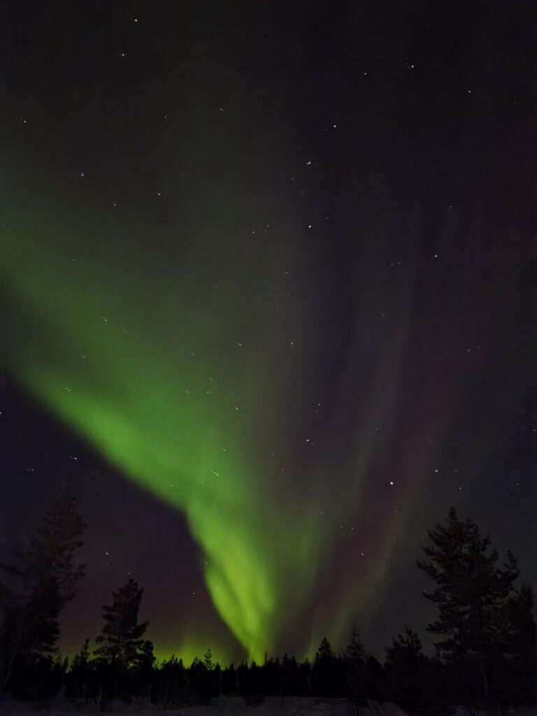
At night, we walked to the lake and saw some northern lights. Suddenly, the sky filled with colours, creating a spectacular show. We didn’t take any pictures as our phones and camera were in the cabin. This was the best northern light display of our stay.
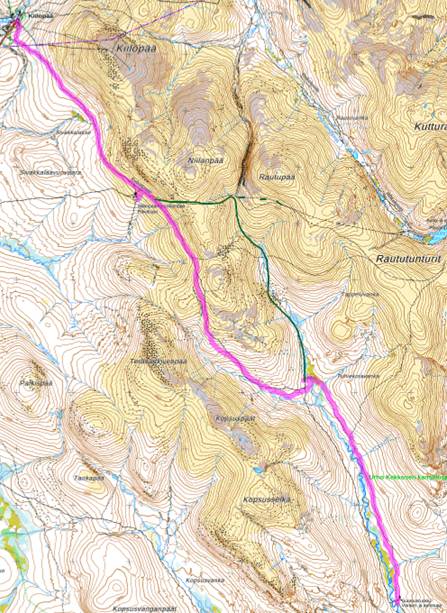
Day 4 – Luirojärvi to Sarvijoki
17,59km | +219 | -228 | 4h50 | Sun
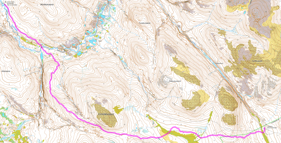
There was a track from previous days going NNE over the lake to Maantielahti, and from there, snowmobile tracks to a small settlement for locals and a water point. After that, we followed an old pulka track along the summer path to the Firepit/Laavu. We enjoyed the sun, started a fire, and cooked makkaras. The track continued north, ascending, whereas we head planned to follow the river. We therefore turned west and made our own track from this point, which was nice because it felt more like being in the middle of nowhere but was also tiring. After reaching the highest point of the valley, we kept right to avoid losing altitude, passed a cliff, and continued north, climbing to a pass at around 390m (Seisomakivenselkä). From there, we descended NE to join the summer path, where tracks reappeared. We followed them to the hut. At one point, the track crossed a river, and the snow bridge was almost collapsing, likely touched by a pulka. We found a better crossing spot further along.
With good weather and no wind, it would have been more scenic to follow the track directly north from the Laavu, leading to a pass at 490m right of Pälkkimäpää, enjoying most of the way without vegetation (green line on the map).
At Sarvijoki open hut, there were two people. We were alone in the reserved hut until 19h when a group of six Dutch people arrived. They used the hut as if we weren’t there, putting their stuff everywhere and leaving a mess on the table when they went to sleep. The next morning, we organized our breakfast while they were still getting up.
Day 5 – Sarvijoki to Lankojärvi
22,30 km | +396m | -490m | 5h49 | Sun
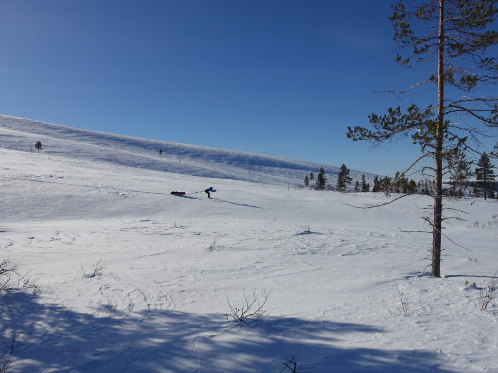
We started heading back to the pass. We tried to follow some descent tracks, but they were too steep to pull the pulka up. We struggled for a moment until reaching gentler slopes. It’s like cycling with full luggage; slopes up to 4-5° are manageable, above that it’s hard, and from 15° it’s almost impossible. Turning on steep terrain with a pulka is challenging (no easy switch like in touring ski), and the vegetation does not always help. A better choice would have been the dashed green line on the map, a gentler, more open slope.
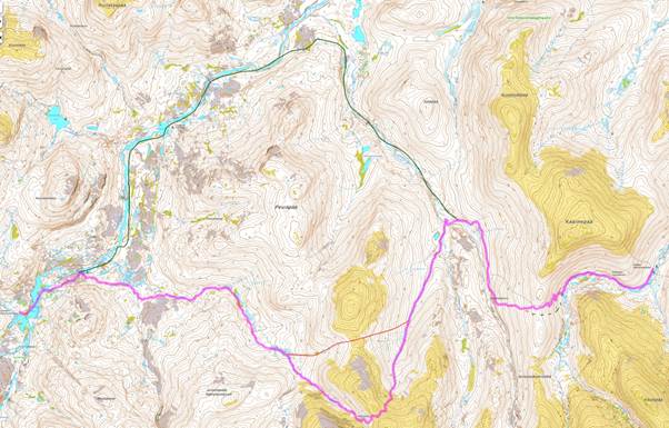
Down in the valley (Maantiekuru), we had two options: follow the river NW and summer path (green line on the map) or take a more direct route over a pass via Kalavanka. As there was a snowmobile track on the direct route, sunny weather, and no wind, we chose that path. It was a beautiful route, gradually ascending above the forest line. Initially, we planned to use the lower pass (red line on the map) but decided to follow the snowmobile track to a slightly higher pass. At some point during the downhill, the snowmobile turned left, and we continued to make our own track. We enjoyed the downhill, with minimal trees and good snow for skiing. Even without a track, it was easy to navigate, as the sunny weather helped maintain direction. In the lower part, we encountered a Sami family with snowmobiles and a large sledge. Their track led us to the Lankojärvi hut.
We were completely alone in the hut; there was also no one in the open hut. While trying to open a bit more the water hole with the axe, Miguel’s phone fell into it to the bottom of the lake. All our photos! Returning to the hut, Eva asked what happened, Miguel was pale. After a bit she decided to take a try and went to inspect the water hole. Five minutes later she came back with the phone which she managed to fish out by lying down on the floor and putting the arm through the hole until touching the ground. Fortunately, the phone was still working!
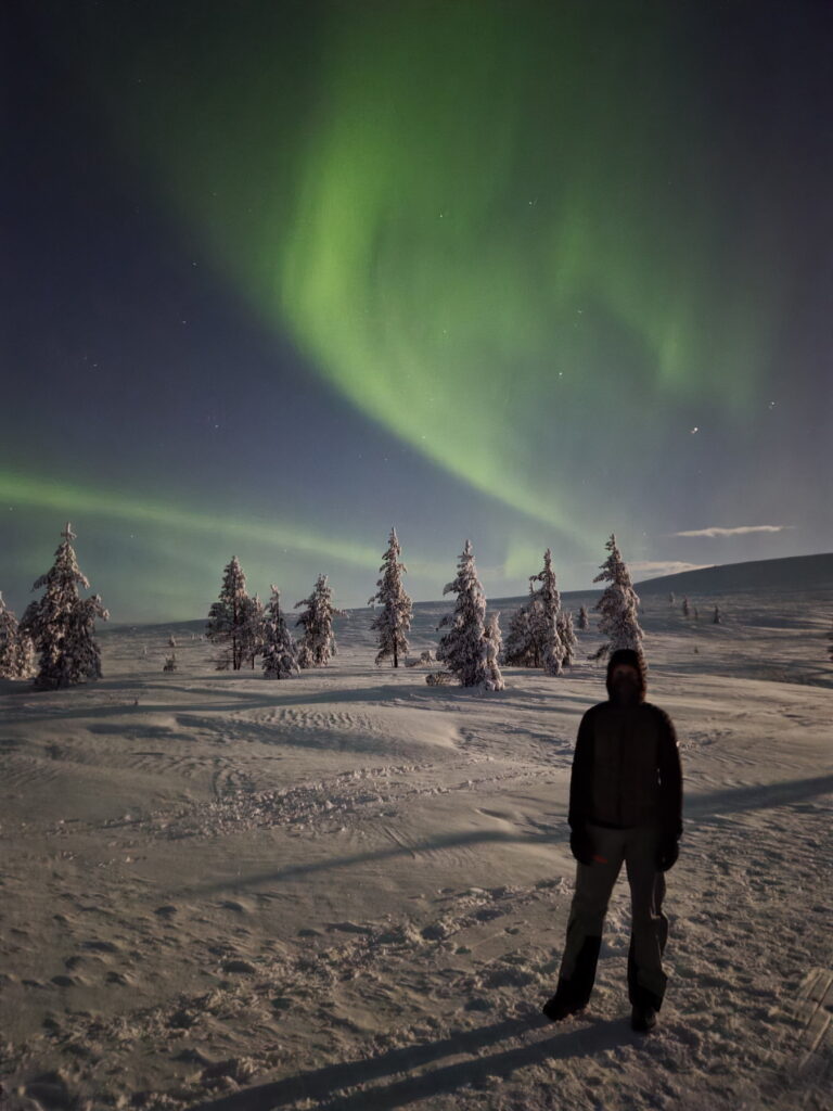
The weather was perfect the entire day, but no northern lights were visible until we went to bed.
Day 6 – Lankojärvi to Kiilopää
21,15 km | +441m | -306m | 4h53 | Covered, a little rain
It was a long but easy day. There was a snowmobile track all the way until we joined the marked nature skiing trails at Rautulampi. It was very windy there, and after a short stop to see the new day hut and open hut (they have more windows, but not much more space than the old ones), we continued on the nature trail NW to Luulampi, where we had been 11 years ago. There’s a café with a large fire in the middle. Last time, we thought you could cook your own makkaras on the fire, but this time it was only for those bought there. We bought beer, coffee, and cake, and decided to cook our makkaras. The owner complained in Finnish but let us continue when realizing we didn’t speak the language.
From there, we could have taken a direct route to Kiilopää, but the snow was very soft, so we decided to return and use the marked nature skiing trail. Around 16h, we arrived at Kiilopää, where we had reserved a comfort cottage with a sauna. We went to dinner and had beer at the buffet restaurant of the hotel.
Conclusion
We immensely enjoyed this backcountry tour: The landscape, the effort, the challenges, the unique Finnish huts. Being most of the time without mobile phone coverage was very relaxing. It was a nice mix of being alone in the middle of nowhere (we met very few people during the day) and of meeting like-minded people (usually in the huts). After the trip, we immediately started studying the map to think about future trips to explore more remote parts of the National Park!
We must say that we were very lucky with the weather (mostly sunny) and snow conditions (not too much snow and still cold enough). With different weather it would have been a different experience.